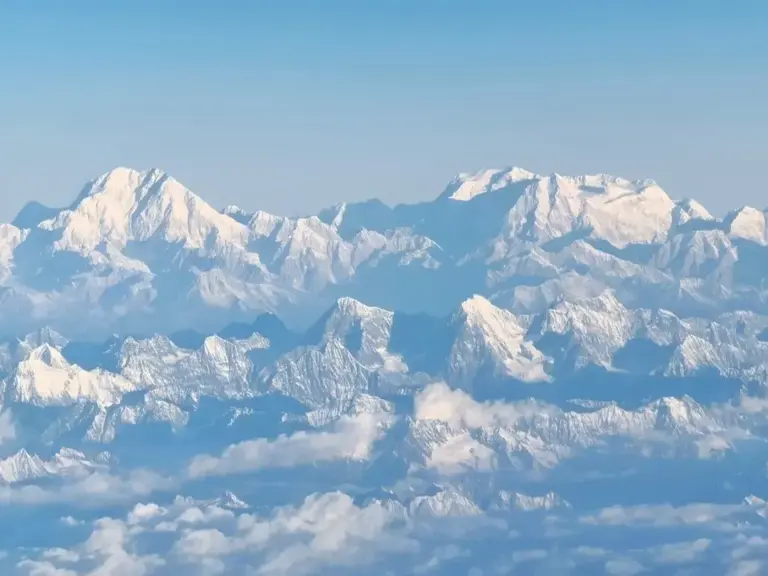
The Karakoram Mountains, “Karakoram” is derived from the Turkic word meaning “black rock mountain”. The Karakoram Mountains are the tallest mountain range with the most developed mountain glaciers in the world and one of the famous mountain ranges in Asia.
The Karakoram Mountains are located on the western border of China, spanning China, Pakistan, India, Afghanistan and other countries, in a northwest-southeast trend, stretching for about 800 kilometers, with an average altitude of more than 6,000 meters and a total area of 200,000 square kilometers.
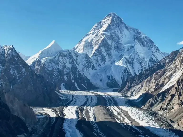
Its main peak, Chogori Peak (K2), is 8,611 meters above sea level, making it the second highest peak in the world. The mountain range stretches from the Wakhan Corridor in Afghanistan in the west, to the Kongkashan Pass on the Sino-Indian border in the south, to the Yarkand River in Xinjiang in the north, and to the Qiangtang Plateau in Tibet in the east, which is an important passage of the southern route of the ancient Silk Road.
The formation and evolution of the Karakoram Mountains is the result of the combined action of the Earth’s tectonic plate movements and natural forces, and its geological history dates back hundreds of millions of years.
Proterozoic (about 2.5 billion to 540 million years ago): This area is covered by the Paleo-Tethys Ocean, with only scattered islands and submarine buried hills. After many movements such as the Caledonian Movement, the Indosinian Movement, and the Yanshan Movement, the ocean basically disappeared, the area was completely landfilled, and the earth’s crust began to be squeezed and uplifted, laying the foundation for subsequent orogeny.
During the Cenozoic, the northward movement of the Indian plate squeezed the Eurasian plate, resulting in a strong uplift of the mountain range, forming large-scale folds and faults. The Karakoram Fault Zone is an important dextral strike-slip fault in the Asian continent, which controls regional geological activity and frequent earthquakes.

Since the Quaternary period, the climate has been humid, and the scale of glaciers has reached its peak, forming large glacier systems such as the Krezing Valley. As the climate dries out, glaciers retreat, but tectonic movements remain active and mountains are further uplifted, forming a modern landscape. In the Holocene, glaciers continued to melt, but the fault zone continued to slide at an average rate of 11 mm per year, maintaining the dynamic equilibrium of the mountains.
The formation of the Karakoram Mountains is a geological epic spanning hundreds of millions of years: from the oceans to the uplift of the land, from the violent squeezing of tectonic plates to the elaborate carving of glaciers, and finally the “backbone of the roof of the world”.
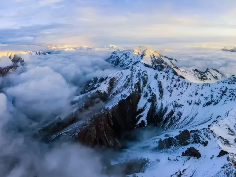
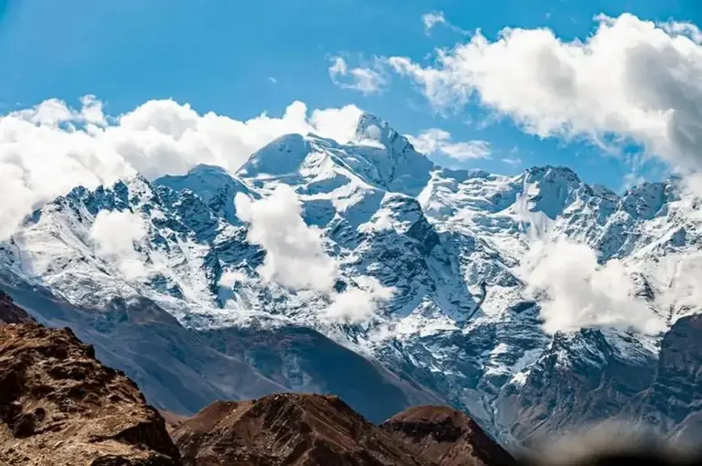
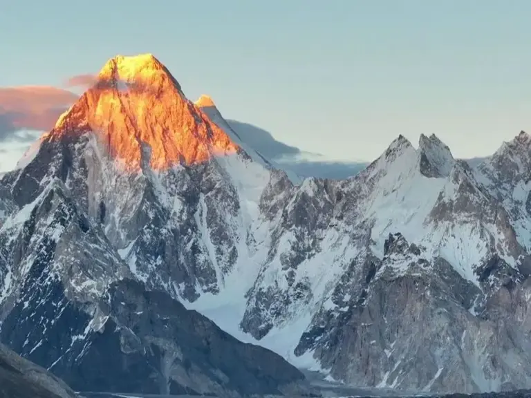
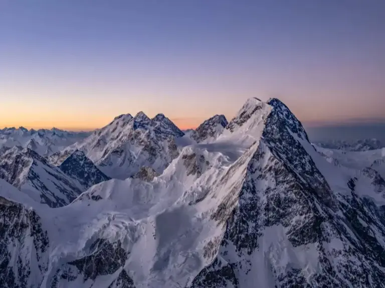
The Karakoram is one of the youngest and steepest mountains in the world with many high-altitude peaks, with an average altitude of more than 6,000 meters. There are 4 peaks above 8,000 meters above sea level, such as Chogoli Peak, with an altitude of 8,611 meters, and 15 peaks above 7,500 meters, with steep mountains and glacial erosion landforms such as polyangular peaks and blade ridges.
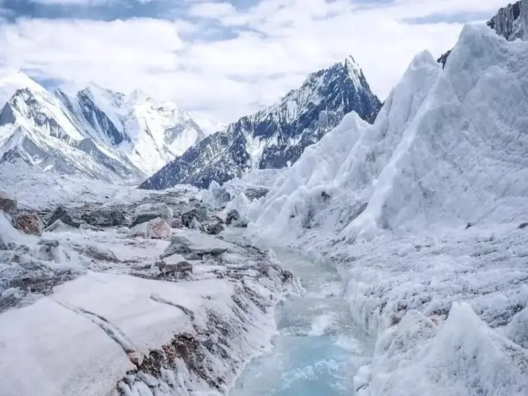
It is one of the most densely populated areas of mountain glaciers in the world, with 37% of the surface area covered by glaciers, covering an area of 74,000 square kilometers, known as the “glacier kingdom”. It is home to many large glaciers, such as Tramukanli Glacier, as well as ice towers, ice caves and other wonders.
The canyon is deeply cut, and the glacial meltwater and river downcutting are strong, forming many deep canyons, such as the canyon cut by the Indus River and its tributaries in the southern foothills of the mountain range, with steep valleys and steep terrain.
The terrain is undulating, the overall terrain of the mountain range is undulating, the height difference from the river valley to the mountain peak is huge, the relative height difference can reach thousands of meters, and the terrain is complex, which increases the difficulty of climbing and passing.
The geological structure is complex, located in the Karakoram fault zone, which is a large dextral strike-slip fault zone in the central part of the Asian continent, which controls the distribution of the Jurassic in the region and the distribution of Mesozoic volcanic rocks in the northern part of the Gangdis Mountains, with various rock types, including granite, gneiss, limestone, etc.
The Karakoram Mountains consist of a number of northwest-southeast trending mountains. From northwest to southeast, the sections are named after the Great Glacier and can be divided into Mount Batura, Mount Shispa, Mount Panma, Mount Bartolo, Mount Siachen, Mount Rimo and Mount Sasser.
The main ridge is flanked to the north or east by Mount Lupukar, Mount Ghajrap and Mount Muztag of Eastern Sather, to the south by Mount Lakapohi, Mount Haramosh, Mount Masha Blumu and Mount Saltoro, and on the southernmost side there is Mount Ladakh. The main peaks are;
– Chogori Peak: At 8,611 meters above sea level, it is the main peak of the Karakoram Mountains and the second highest peak in the world.
– Mount Gashul Burum: At 8,068 meters above sea level, it is one of the famous peaks of the Karakoram Mountains.
– Bloat: At 8,051 meters above sea level, it is the twelfth highest peak in the world, located on the east side of Chogori Peak.
– Gashul Blumu II. Peak: At 8,035 meters above sea level, it is one of the peaks in the mountain range with an altitude of more than 8,000 meters.
– Skyangkanli Peak: 7,545 meters above sea level, located on the northern side of the Karakoram Mountains.
– Span de Peak: 7,385 meters above sea level, on the western side of the Karakoram Mountains.
– Crown Peak: At 7,295 meters above sea level, its unique shape attracts many mountaineers and explorers.
During the Sui and Tang dynasties, the Karakoram Mountains were the necessary places for the southern route of the ancient Silk Road, and the Kladak Pass and the Karakoram Pass in the mountains were the gateways to Central Asia, promoting trade and cultural exchanges between China and Central Asia, West Asia and Europe.
The entire Karakoram Mountains are dotted with Buddhist and Islamic relics, including ancient stupas dating back to the 7th century AD, places where Silk Road merchants stopped to pray for blessings, and imposing ruins of ancient cities.
In the mid-to-late 19th century, the Karakoram Mountains became a strategic location coveted by the great powers due to their special geographical location. After the partition of India and Pakistan, parts of the Karakoram Mountains became disputed between India and Pakistan over the ownership of Kashmir.
The Karakoram Corridor was illegally annexed to British India by the British, but Pakistan took control of it after independence, and in 1963, China and Pakistan reached an agreement to return the Karakoram Corridor to China.

The Karakoram Mountains are rich in mineral resources, with the first in China, the second in Asia, and the seventh in the world. In addition, the Karakoram Mountains are connected to the Kunlun Mountains, forming a rich jade resource belt, with high-quality Hetian jade.
At the same time, it is also the tallest mountain range with the most developed mountain glaciers in the world, and has the reputation of “glacier kingdom”, with ice reserves of 539,141.6 million cubic meters.
The total area of glaciers in the mountain range is 18,600 square kilometers, of which about 102 glaciers are more than 10 kilometers long, and there are 8 mountain glaciers in the world with a length of more than 50 kilometers in low latitudes, of which the Karakoram Mountains account for 6. Large glaciers provide abundant and stable runoff from melt water such as the Yarkand and Indus rivers.
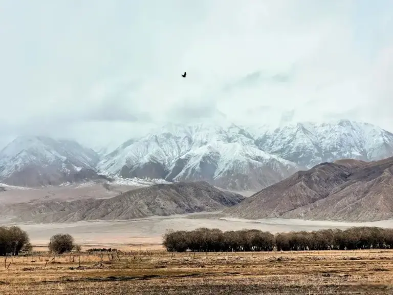
The climate is an alpine inland climate, cold and arid, with a large temperature difference between day and night. Affected by the westerly wind belt in winter, precipitation is concentrated in high-altitude areas (800-2400 mm of annual precipitation above the snow line), and summer is dry and rainless.
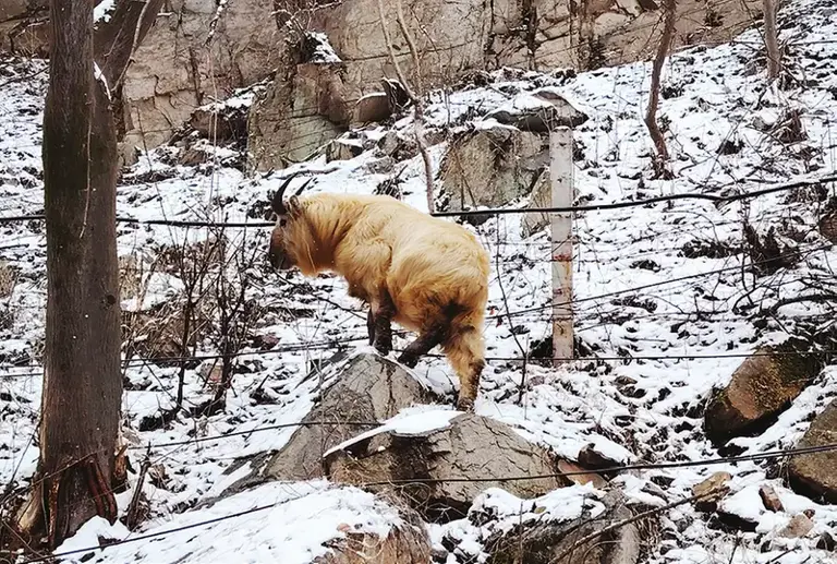
The vegetation is dominated by desert, alpine steppe and meadow, which is vertically distributed with the increase of altitude. Rare species such as snow leopards, Tibetan antelopes, and ibex inhabit here, and some areas are listed as nature reserves.
The Karakoram is a paradise for mountaineers and explorers from all over the world with its many peaks, such as Chogori Peak. There are also unique glacier landscapes such as ice towers and ice sculptures at Tramukanli Glacier, as well as Pangong Lake, an international lake.
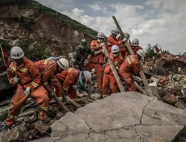
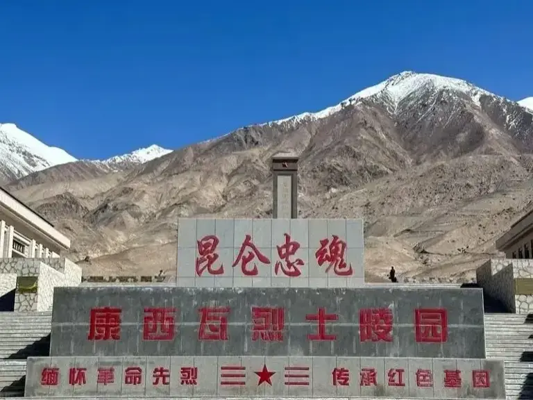
In the Karakoram Mountains of China, there is the Kangxiwa Martyrs Cemetery, where the martyrs who died defending the motherland’s borders and building the Xin-Tibet Highway are buried, which is a testimony of the selfless dedication of Chinese soldiers to defend the country and defend the borders.